Submitted by ls65536 t3_115xup2 in dataisbeautiful
Comments
Alternative-Sea-6238 t1_j94ynwp wrote
Fishing, tourism (e.g. whale and polar bear watching) and research? I'm guessing.
hcase5 t1_j9509n4 wrote
It’s a simulator, not real. For real ships, look for MarineTraffic density map, example
Alternative-Sea-6238 t1_j950tlk wrote
Thanks, I didn't properly read the title. Is this a gaming simulator or a research simulator or some other purpose?
[deleted] t1_j95cjyj wrote
[removed]
nodakakak t1_j95t0jb wrote
Commerce. Ice breaking and northern transit routes.
ls65536 OP t1_j93x96d wrote
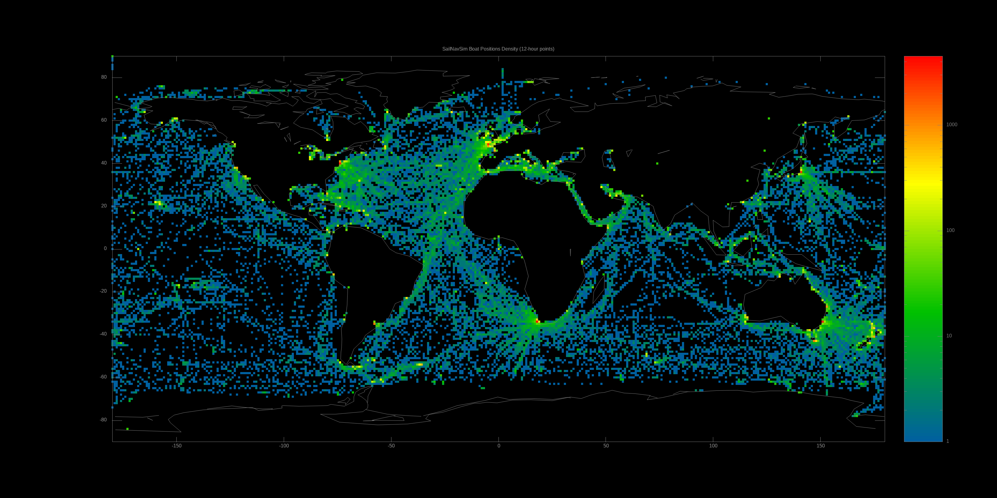
This is a heatmap showing the density of virtual boat positions (captured every 12 hours in this case) over the past couple years in the SailNavSim sailing navigation simulator [1].
Data was extracted from SailNavSim's SQLite database, and the image was generated using Gnuplot.
Cubrix t1_j952i51 wrote
Kind of interesting with the black areas, must be like the bermuda triangle, very interesting how these areas of the sea are unexplored
hcase5 t1_j95cmdg wrote
It’s a simulator, not real
Lady_Rose36 t1_j96cr7g wrote
The joke is that those areas are land
[deleted] t1_j95pd0l wrote
[removed]
[deleted] t1_j96cjy5 wrote
[removed]

that___dood t1_j9457nd wrote
There a lot more going on in the arctic than I woulda thought