Submitted by azsoup t3_z129yf in Pennsylvania
Comments
hossCEO t1_ix8n6ap wrote
This is really cool where did you find this? I spent a ton of time at that dam growing up
azsoup OP t1_ix8nxkr wrote
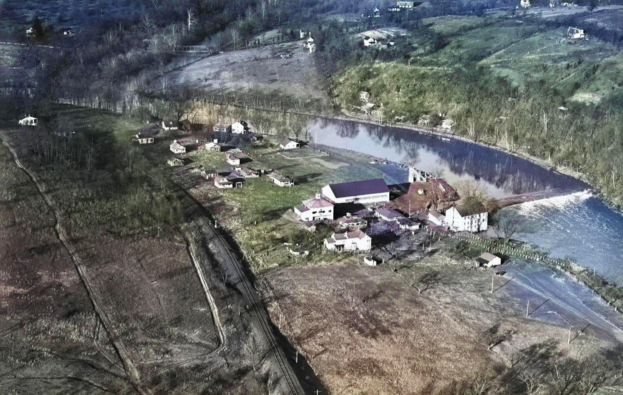
Me too! I’ve fished every inch of creek in this picture. I’m a model railroader and asked for some pics from the Perkiomen Railroad Historical Society. They are on Facebook as well (I think).
ktappe t1_ixa9j0i wrote
And isn’t the railroad you’re referring to in the middle of the picture now the Schuylkill River Trail?
azsoup OP t1_ixag4xu wrote
Good question! The tracks seen in the center would become the Perkiomen Trail.
The Schuylkill River Trail is a mile south of this picture. The Schuylkill River Trail sits on what was, for a time, the Pennsylvania Railroad that ran between Philly and Harrisburg.
wh0_RU t1_ixb1wtg wrote
SRT still follows the rail line to Reading pretty closely, just on the other side of the river(in berks)
OneTrueDweet t1_ixaqrcr wrote
Nary a Wawa In sight.
premelia t1_ix95oft wrote
Very cool, I live in this area!
-Motor- t1_ix9m53v wrote
Is that water running through the driveway/parking lot bottom right?
ktappe t1_ixa9mr0 wrote
Zooming in, I don’t think so. It may have been flooded at some point prior to the photo, which explains the coloration, but I don’t think it’s wet at the time of the photo.
five_eight t1_ixa9zv7 wrote
Water looks pretty high, though. Only a foot or two of water coming over the dam before it hits the flow. Pic might have been taken because of flooding.
-Motor- t1_ixahzl8 wrote
That's my thinking.
Go look at aerials on Google maps if the current day. There's an island just below the dam now, where this is.
Careful-Lawfulness-5 t1_ixb510b wrote
It appears the large white house is surrounded by water. It does seem like the photo was taken to document a flood.
WoodpeckerBigAF t1_ixazqgw wrote
Wow, I grew up right by there! It’s crazy to think there’s a major highway blasting through there these days. My parents used to say that area was the sticks when they moved out there, i guess they were right lol
momlin t1_ixafpxa wrote
Wow, right near me, thanks for sharing!
Qpracs t1_ixd25jv wrote
Wow. That is amazing. I am surprised that is in color. Someone must have painted over a black and white photo. It must have been taken from a low flying plane since helicopters weren't around.

azsoup OP t1_ix8ixje wrote
The railroad seen in the photo was the start of the Perkiomen branch that ended in Emmaus, PA. This rail line helped link Philadelphia with farms and factories along the Perkiomen.
A bridge over the Schuylkill at Perkiomen Junction would link the Perkiomen Branch to the Pennsylvania railroad.
The Skippack Creek can be seen in upper left hand corner (look for the steel girder bridge). The rail would be removed in the 2000s to make way for the Perkiomen Trail.